
2022-2023 High Water Roundup
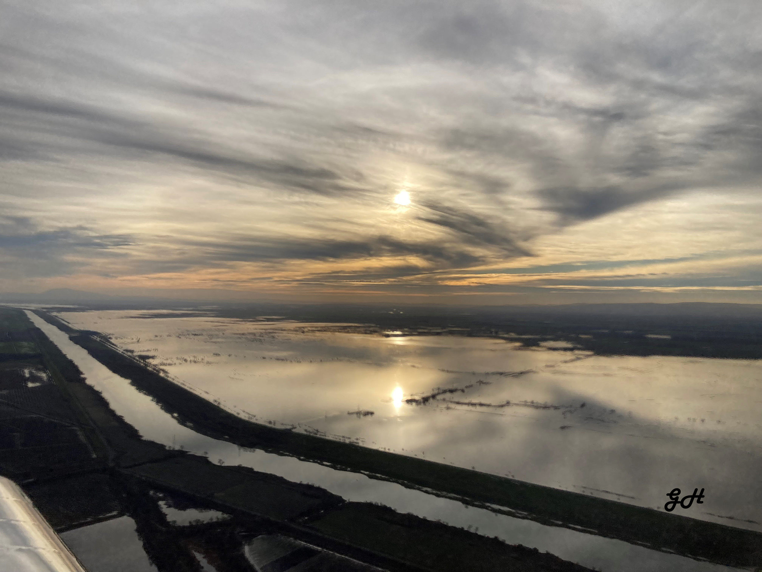
The Yolo Bypass, pictured here, is a vast flood control structure that diverts large flood flows around cities and communities such as Sacramento and Davis. When flooded, the Bypass provides excellent fish and migratory bird habitat, and nourishes the Delta food chain. Image courtesy of GH.
2022–2023 has shaped up to be one of the better high-water water years in California history. Specifically, it felt like 1983 — a high snow pack year.
The many storms this water year came in with low and moderate snow levels, piling up large quantities of snow, creating the promise of a long and generous runoff season. But here’s some highlights from a floodwater management perspective.
Sacramento Valley: As widely understood by flood managers and climate scientists, it takes very large rainfloods to imperil the large cities and lands protected by Sacramento Valley flood-control systems. And here, snowmelt floods can never be large enough to exceed levee-to-levee river capacities. With no significant rainfloods this year, Sacramento Valley flooding was never a risk.

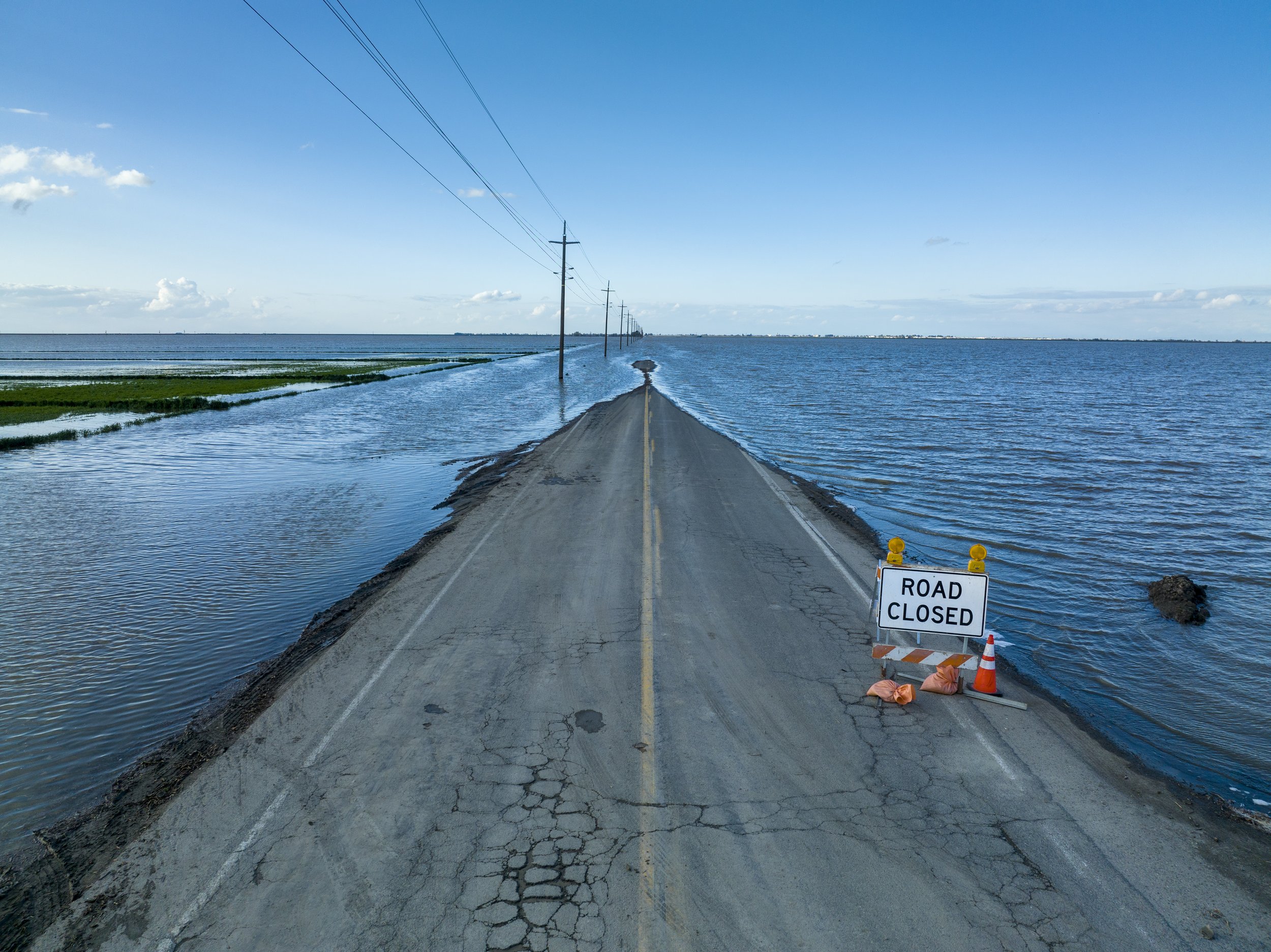
The Cosumnes River spilled its bounty of water this January with the adjacent lands. This photo overlooks the Cosumnes, City of Wilton, and the Sierra Nevadas in the background. Courtesy of GH.
Cosumnes River: This river is one of the few significant watersheds in the Sierra Nevada that reach the Central Valley floor largely undammed. With the only storage reservoir, Sly Park (Jenkinson Lake), not controlling much of the watershed, rainfloods here easily exceed bank-full flows, and the “sugar” levees here are easily broken. Such breaks happened this year, with the insufficiently bridged Highway 99 experiencing flooding. Sacramento County’s floodplain management policies understand the dynamic nature of this watershed, discouraging levee improvements that act as temporary floodwalls and causing high flood stages elsewhere before the levee breaks and the backed-up water plunges downstream. Looking forward this year, the generally low elevation of this watershed means that snowmelt floods will cause far less difficulty than rainfloods.
Mokelumne River south to the San Joaquin River: The constrained levee-to-levee river capacities mean that the multi-purpose reservoirs with flood-control reservations (room to catch floods) cannot release enough water to prevent encroachment into the flood reservation spaces for either rainfloods or snowmelt floods (there are different Corps of Engineers requirements for each type of flood). This year’s rainfloods in these partially dam-controlled watersheds were not sufficient in size to cause downstream flooding.
However, unlike the Sacramento River basin experience, in 2023 there could be snowmelt floods from either dam and channel exceedances as mentioned above, or levee failures from sustained high flows. Long durations of wetness on levees makes them more susceptible to failures. Still, these snowsheds did not experience the degree of departures from average precipitation as in the Tulare Basin watersheds. Nevertheless, these snowmelt watersheds may still experience snowmelt flooding, although the generally dry Spring may mitigate these challenges. To improve floodwater management in this basin, larger floodways downstream of Corps of Engineers-managed dams are needed (for example, Sacramento basin floodways are ten times the size of San Joaquin basin floodways). The Tuolumne River managers are taking baby steps to address this. We should be able to give you a report later this year.
On the positive side, water conditions in the San Francisco Bay-Delta have improved. And, because the San Joaquin River will be high this year, Central Valley eastside and westside water deliveries and State Water Project water deliveries to the south state will be generous (the highly over-diverted San Joaquin River tends to be a limiting factor on Delta pumping even though the Sacramento River is the juicier watershed).
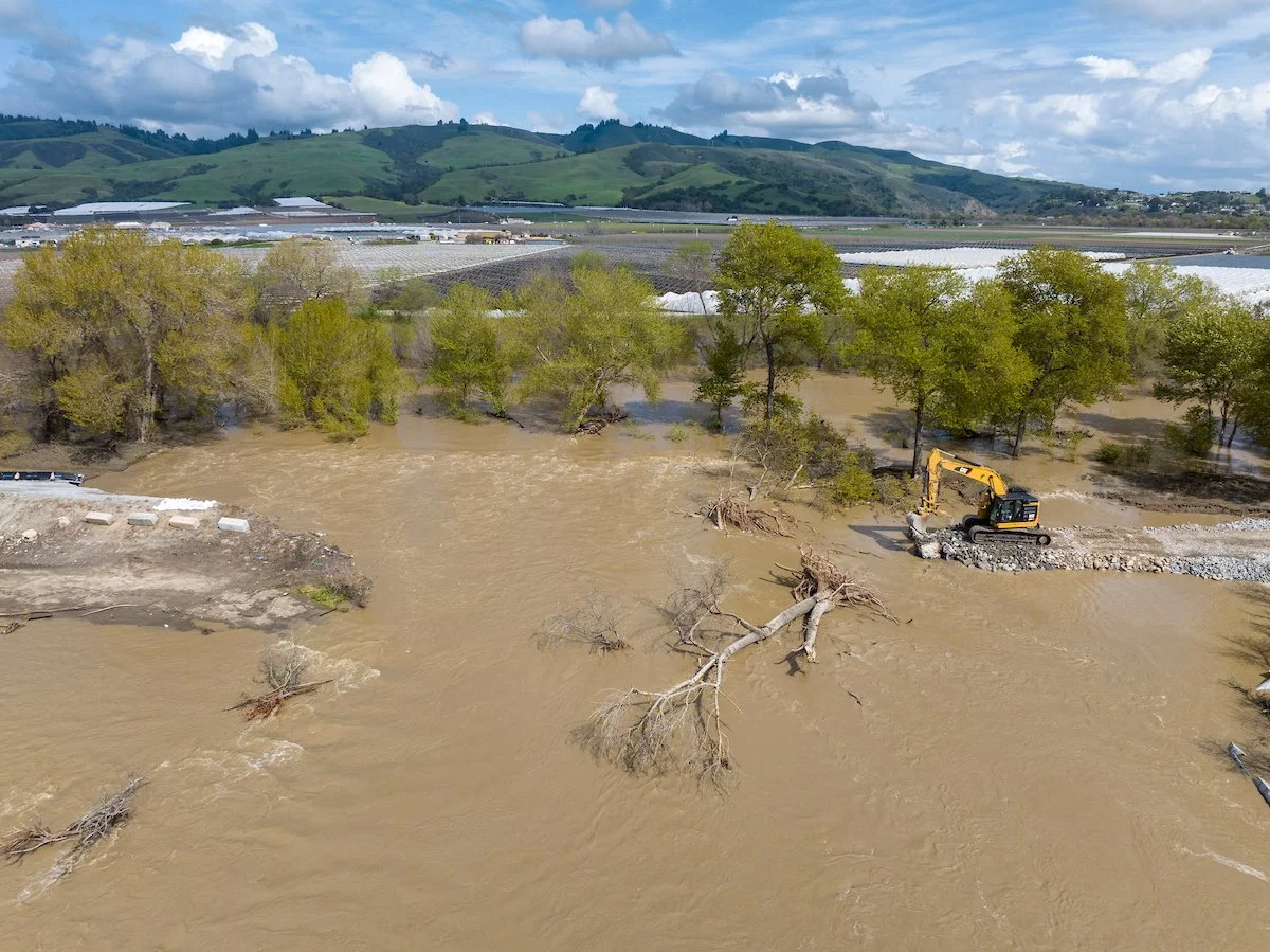
The flooding has reclaimed portions of Tulare Lake this year. This image depicts flood waters covering a large portion of 6th Avenue in the Valley town of Corcoran. Image courtesy of CA DWR.
Tulare Basin rivers: The Tulare basin watersheds did experience some minor but significant rainfloods this year, but the main show will be the coming snowmelt floods. Flooding of either type in this region exposes the lack of planning to manage the inevitable occasional snowmelt floods and increasing rainflood risks (it exposes the power of wealthy farming corporations too). Fights over which levee to break first occur here with no one really in charge of such matters, unlike the basins further north at least nominally controlled by the U.S. Army Corps of Engineers and the California Central Valley Flood Protection Board. Tulare, Buena Vista, and Kern Lakes have appeared this year, and at least a couple of communities in the Tulare Lake area will experience flood risks.
Central Coast watersheds: The generally low-elevation watersheds here mean that most large rain events are rainfloods, regardless of whether much of the rain over the Sierra Nevada is falling as snow. Flood risk arises from cities and communities occupying natural floodplains protected by poorly-located and bulwarked levees. That happened this year along the Pájaro River (tributary to Monterey Bay) this year. The levee broke, and Pajaro flooded.
Crews hard at work to repair the levee break along the Pajaro River. Courtesy of CA DWR.
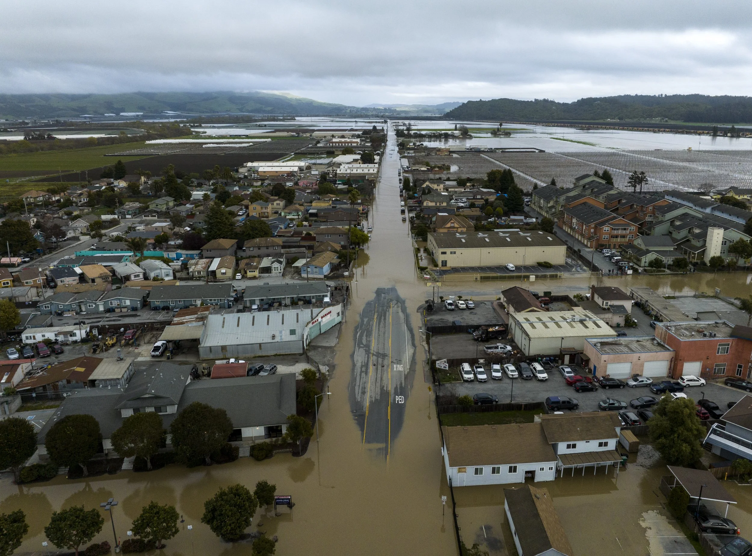
A levee break along the Pajaro River caused extensive flooding for the central coast community of Pajaro. Courtesy of CA DWR.
Flooding along Bear Creek in Merced, January 2023. Courtesy of CA DWR.
Similarly, two small somewhat leveed streams exceeded their channel capacity in Merced County, and the community of Planada and a small part of the city of Merced flooded.
It’s important to note that each of these small flooded communities are categorized as disadvantaged communities by the State of California. As climate change continues to exacerbate weather whiplash and increase the likelihood of floods, Friends of the River and our partners are advocating for equitable distribution of resources and protection of vulnerable communities.
The lessons learned from these floods could be (1) better floodplain management, such as limiting development or increasing floodproofing in high-risk flood areas; (2) increased structural flood-control works, such as completing the Paradise Cut bypass in the west Delta; or (3) a better flood insurance system, such as a community-based flood insurance program. Those are public policy issues that we as citizens of California and the Nation need to confront.
Resources
Article on Sacramento Valley Flooding, Ron Stork, River Advocate, Jan 2023
2023 Cosumnes Flood articles in the River Advocate and Sacramento Bee
2023 Planada Flood articles in the River Advocate and The Guardian
Climate Change is Increasing Risk of a California Megaflood, Huang and Swain