
Whittier Narrows Dam, the Price of Keeping Nature at Bay
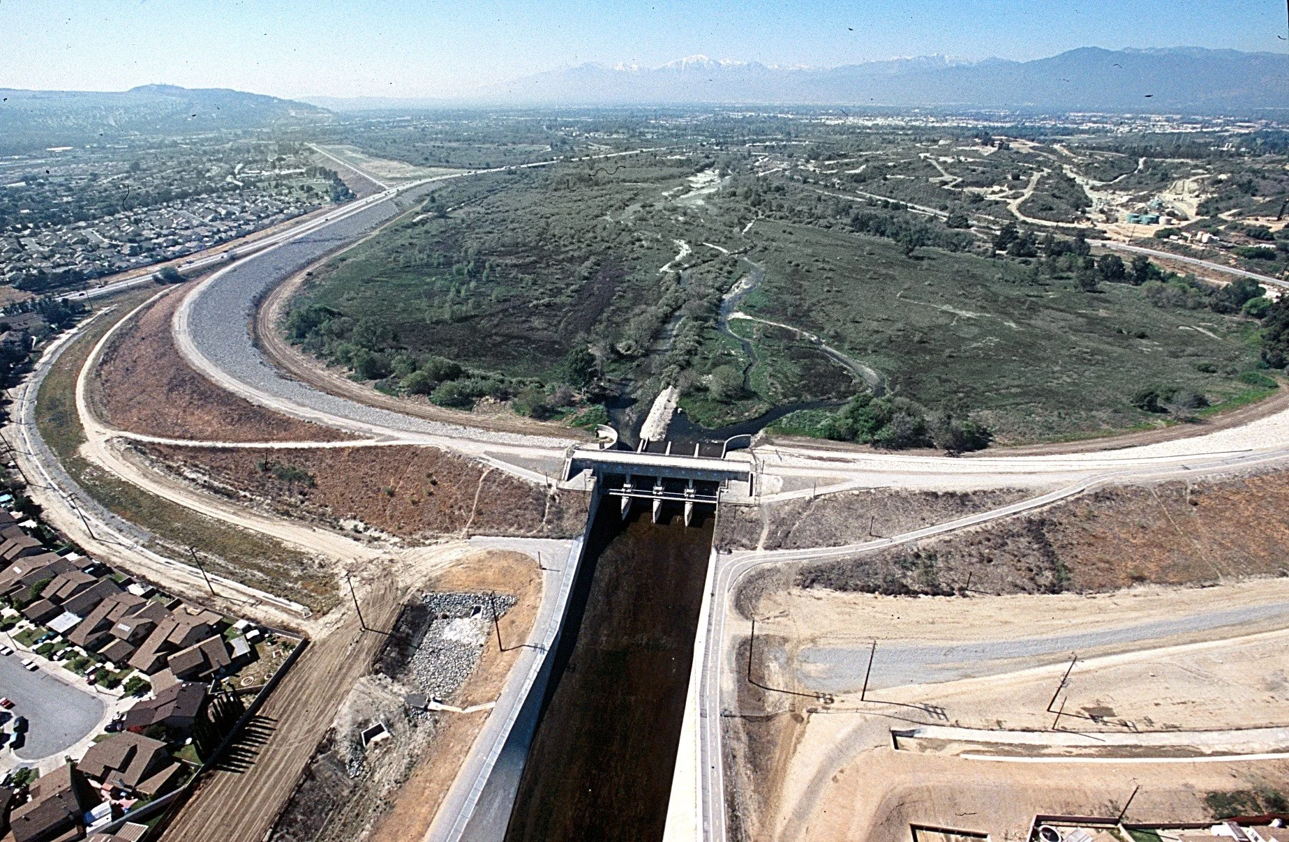
Aerial of Whittier Narrows Dam. Photo Credit: Army Corps of Engineers
I grew up in Southern California on an alluvial fan. A lot of us did.
An alluvial fan is a defining feature of our landscape—a broad, fan-shaped deposit of sand, gravel, and boulders built over thousands of years as streams and rivers flow out of steep mountain canyons onto flatter land. These landforms created much of the ground beneath our neighborhoods, schools, and businesses, even if most of us never realized it.
For me, it was the canyons of the San Gabriel Mountains that collected the water that delivered the sand that formed the fan that we lived on. At that time, some of these fans were not covered with houses and businesses. Now it’s nothing but.
There, the streams and rivers that delivered the sand, rock, and boulders that formed the fans had been tamed by floodwater management dams that inhabited many of the mouths of the mountain canyons visible throughout the southland. Below the dams, the natural river channels were usually turned into concrete channels. More dams and concrete channels have been built during my lifetime.
Many southland residents old enough to see the loss of these natural waterways mourned their loss while, at the same time, enjoying the reduced risk of community flooding.
The U.S. Army Corps of Engineers and county flood control districts did this work. The Corps was designing the projects back then to control the “standard project flood.” It was the Weather Service and Corps’ estimate of the largest reasonably foreseeable flood. That was the standard for urban areas, and Southern California was becoming decidedly urban. The dams themselves and their spillways were to meet even more rigorous standards.
The San Gabriel and Rio Hondo Rivers lie in the next watershed west of my old house. These rivers have some concrete and semi-natural channels in the San Gabriel Valley, then they each have to navigate a gap between the Montebello and Whittier Hills before hitting the next equally urbanized valleys below, including the southland’s famous Orange County.
This gap is where the Corps’ Whittier Narrows Dam lies. The dam throttles the flows of both rivers, either individually or together (the latter in big floods), with the Rio Hondo then flowing into the Los Angeles River and the San Gabriel into the ocean.
The dam is nearly 70 years old, so the Corps is tending to some structural deficiencies and adding some additional capacity (flood estimates have grown since back in the day).
“Tending” to this isn’t cheap. The Corps estimates that it will need $1.367 billion, with 100% to be assumed by the U.S. taxpayers, a bit more than the usual 15% for a dam-safety project and 65% for a floodwater management project. Westerners have always relied on the kindness of strangers.